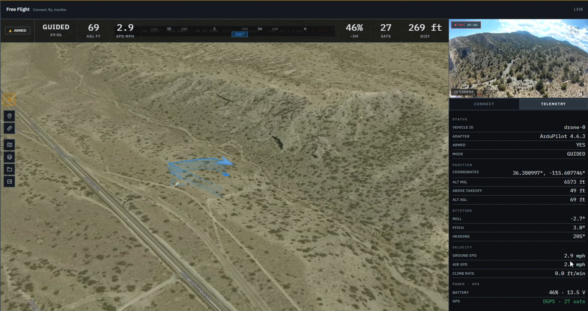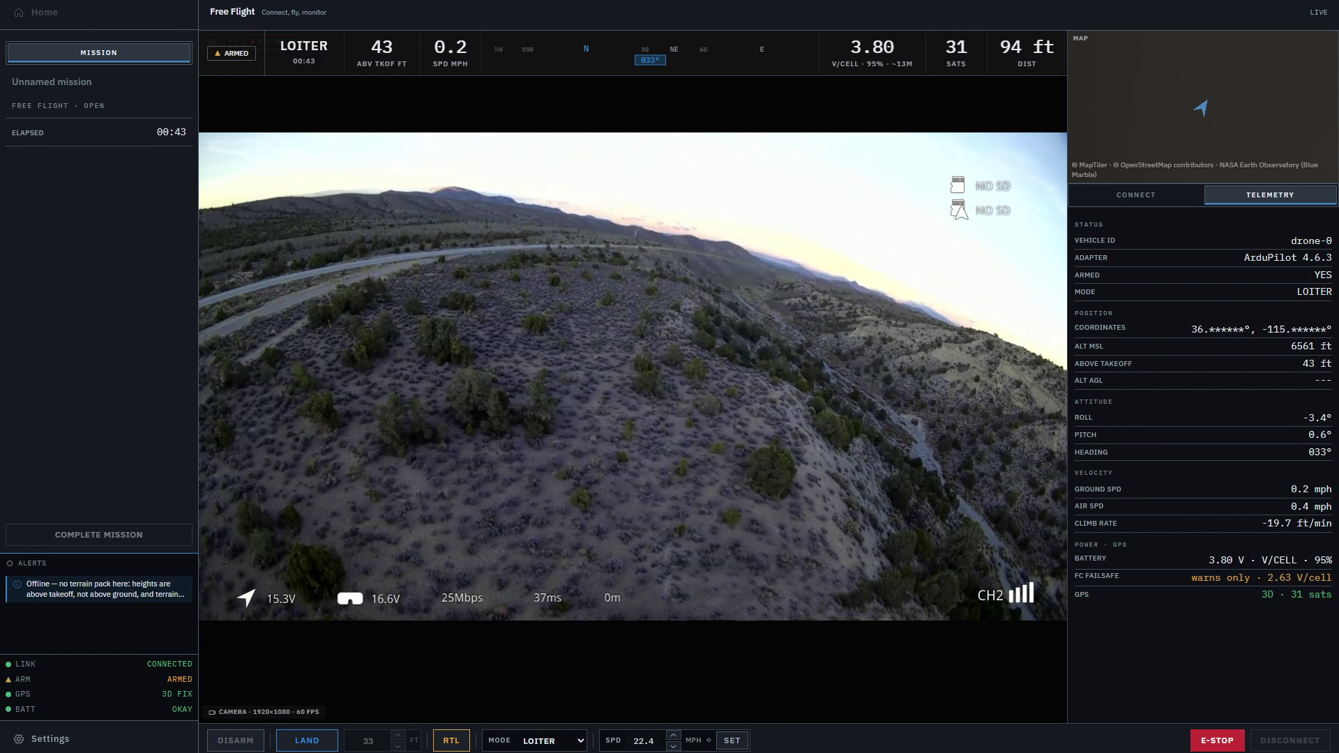
A drone’s altitude only makes sense when you know what it’s measured from. AGL means above ground level, MSL refers to mean sea level, and height above home uses the aircraft’s home position as its reference.
All three can describe the same aircraft at the same moment and give you different numbers. Nothing has to be broken for that to happen.
The confusion usually starts somewhere ordinary. You’re watching a flight, the altitude looks steady, and the aircraft heads toward higher ground. The number barely moves. The gap underneath the drone does.
That’s where the label beside the number earns its space on the screen. Once you know which reference you’re reading, the hillside example becomes fairly simple arithmetic.
Three ways to describe the same height
Think of each reference as choosing where to put zero.
| Reading | What it is measured from | What it tells you |
|---|---|---|
| AGL — above ground level | The ground directly beneath the aircraft | Its vertical separation from that ground |
| MSL — mean sea level | A sea-level reference | Its altitude on a reference that can also describe terrain elevations |
| Height above home | The elevation assigned to the aircraft’s home position | How far above or below that reference it is |
ArduPilot’s guide to understanding altitude explains these references, along with the distinction between the altitude the autopilot estimates and the altitude it is trying to reach.
AGL follows the ground beneath the aircraft. Height above home keeps referring back to home, even after the aircraft has flown away from it. MSL lets you compare elevations over a wider area, provided the values use compatible vertical references.
You may also see AMSL, meaning above mean sea level. In this context, an altitude described as MSL or AMSL is using a sea-level reference. Neither label means the aircraft is that far above the hillside underneath it.
Put an aircraft over a hillside
Let’s use a made-up flight with round numbers. Home is on ground at 500 meters MSL. The aircraft climbs to 600 meters MSL, putting it 100 meters above home.
Directly over that same ground, it is also 100 meters AGL. For the moment, the two readings agree. That can make them feel interchangeable.
Now let the aircraft move over a hillside while staying at 600 meters MSL. The ground below rises to 550 meters MSL. Home is still back at 500 meters.
- Above home
- 100 m
- Above ground (AGL)
- 50 m
- Above sea level (MSL)
- 600 m
The aircraft is now 50 meters AGL, while still 100 meters above home. Its MSL altitude hasn’t changed. Neither has its height above home. The ground has used up half the gap.
For this simplified example, the calculations are:
- Height above home: 600 − 500 = 100 meters.
- Height above ground: 600 − 550 = 50 meters.
The second calculation needs the elevation beneath the aircraft’s current position. Subtracting the elevation at the launch point would answer a different question.
Reverse the trip and the same idea works downhill. If the ground drops to 450 meters MSL while the aircraft stays at 600 meters, the gap becomes 150 meters. The above-home reading can sit at 100 the whole time.
Our earlier article, Why Drone Pilots Need More Than a Dot on a Map, uses a hypothetical hillside flight to show why the terrain, aircraft position and readings need to be understood together. These are the numbers behind that example.
Home is a reference, not the ground everywhere
Height above home is convenient because it gives the flight a local starting point. It’s much easier to think about climbing 30 meters from a nearby launch area than to keep doing arithmetic with a large sea-level elevation.
But the word home deserves a little attention. A display might use home, the takeoff position or the estimator’s origin as its reference. Those can begin in the same place without meaning the same thing. ArduPilot distinguishes HOME from ORIGIN: home can be moved, while the origin stays fixed unless it is deliberately reset. Check what the particular reading uses before treating those labels as synonyms.
The distinction also explains a reading that can look strange at first: a negative height above home. In another made-up example, home is at 500 meters MSL, the aircraft is at 480, and the ground beneath it is at 430. The aircraft is 20 meters below home’s elevation and still 50 meters above the ground.
The minus sign describes its relationship to home. It doesn’t, by itself, mean the aircraft has gone underground.
Where the altitude number comes from
The reference tells you what a number means. The source tells you how the system arrived at it.
A barometer measures air pressure, which can be used to estimate altitude changes. ArduCopter’s Altitude Hold documentation describes its use of barometric altitude and the effect of changing pressure. It also describes using an enabled downward rangefinder within the sensor’s working range. These are different ways of gathering information about height; a pressure reading is not a direct measurement of the gap to the ground.
A displayed height above terrain may instead use a terrain database. MAVLink’s altitude message definitions distinguish altitude above home, altitude above terrain and an estimate of clear space below the aircraft. They also account for terrain height coming from a database or an altimeter. A ground station may not receive or display every one of those values.
That’s a useful question to ask of an AGL label: is this based on a sensor looking down, or on the aircraft’s estimated altitude and stored terrain elevations? The label alone doesn’t tell you. A terrain-derived value depends on the position and elevation data used to calculate it. A sensor has its own range and measurement limits.
There is one more wrinkle when comparing GPS readings with maps. Some heights are measured above a mathematical model of the Earth called an ellipsoid. Those aren’t automatically the same as sea-level heights. NOAA’s explanation of vertical datums describes how these reference surfaces differ.
You don’t need to become a surveyor to read the flight display. You do need compatible references before subtracting a map elevation from an aircraft altitude. Both values being labeled “meters” isn’t enough.
Holding altitude doesn’t always hold the gap
In our hillside example, staying at 600 meters MSL is a perfectly consistent altitude. It still brings the aircraft closer to rising ground.
Terrain following adds another job: changing the aircraft’s altitude as the ground changes. ArduCopter’s terrain-following documentation describes supported behavior using terrain data or a downward rangefinder, depending on the mode and setup. It is something the aircraft and control system must support and be configured to use.
Simply drawing a hill in a ground station doesn’t make the aircraft climb over it. The picture and the flight behavior are separate parts of the system.
An AGL estimate also needs to be read with the terrain source in mind. Trees, buildings and other objects may be missing from the data. A value calculated from the terrain surface cannot establish clearance from everything along the route. A more detailed-looking map doesn’t settle that question on its own.
Read the reference before setting the number
The same distinction matters when entering a planned altitude. “100 meters” is incomplete until the software knows what those meters are measured from.
MAVLink defines mission coordinate frames that distinguish sea-level, home-relative and terrain-relative altitudes. Support varies by command and vehicle. Changing the reference can change the physical height you’re asking for, even if you leave the number alone.
Planning software also has to work before an aircraft is connected. QGroundControl’s Plan View documentation distinguishes a planned home position used for estimates and drawing the route from the actual home position set by the vehicle. A marker placed while planning isn’t proof of the home reference the aircraft is using during a flight.
When looking at a reading or a planned value, four details are worth keeping together:
- The reference: sea level, home, takeoff, origin or terrain.
- The units: meters and feet can both appear in flight tools.
- The source and age: what produced the value, and whether it is still current.
- Its role: a reported altitude and a target altitude answer different questions.
Back over the hillside, those details explain why one steady number can sit beside a changing situation. Height above home tells you about home. AGL tells you about the ground below. MSL gives you a common reference for comparing elevations when the data is compatible.
That relationship is part of what we’re working to make easier to read in Markhor, with terrain, aircraft position and telemetry in the same workspace. The terrain view provides context; it does not provide terrain following or obstacle avoidance. Markhor is in active development and is not yet available outside Lechuza.
An altitude value is useful. Knowing where its zero is makes it much more useful.